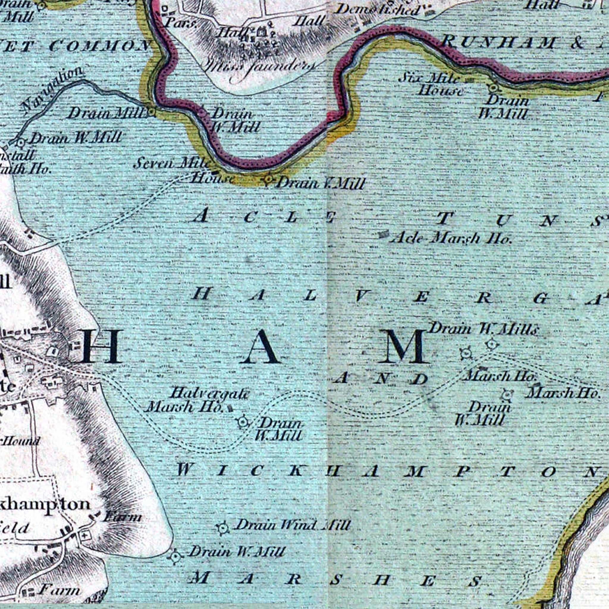
Faden's 1797 Map of Norfolk
This is an extract from Faden's Map of Norfolk first published in 1797.
The book containing the map, which has an excellent introduction by J C Barringer, is available from Amazon.
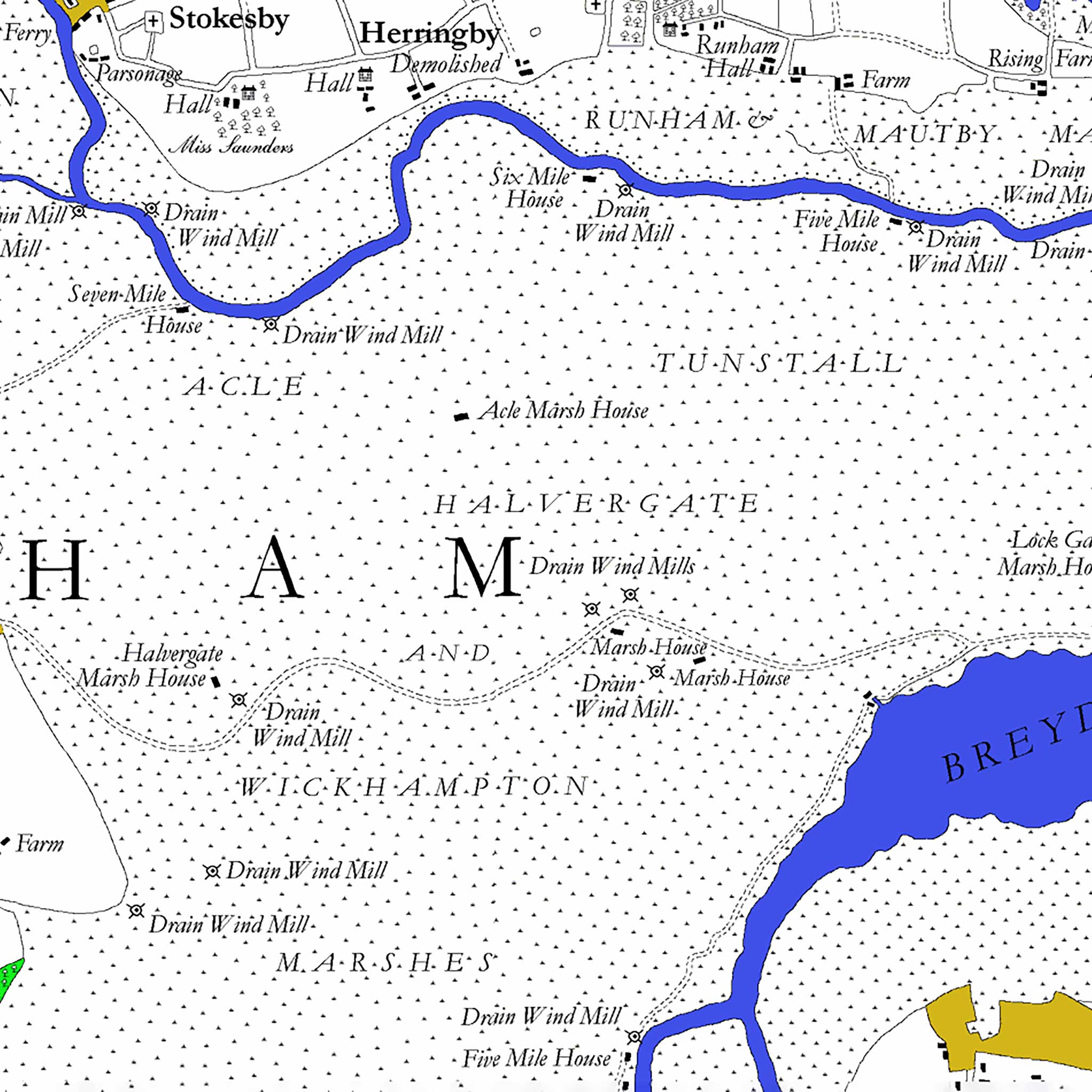
The maps are also available on the web, including a neat digitally redrawn version - well worth exploring -http://www.fadensmapofnorfolk.co.uk/
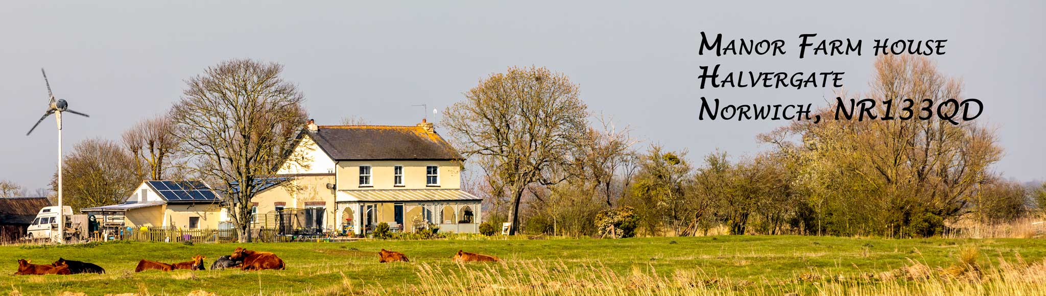
Possibly the current day Manor Farm House is shown as "Halvergate Marsh Ho." Or perhaps the "Marsh house" further along. I need to study it more and check scales and distances.
The absence of Acle "New Road" (not built until 1831) and Branch Road (also built in 1831) is clear. The "Drain W.Mill" at the top of the extract is probably Stracey Arms mill. Mutton's mill is shown as "Drain W.Mill" just below the house. Interestingly there is no road or track shown to access the house - access must have been even worse than now!
 |
 |
Some old images of the house and surroundings.