Our House on Halvergate Marsh
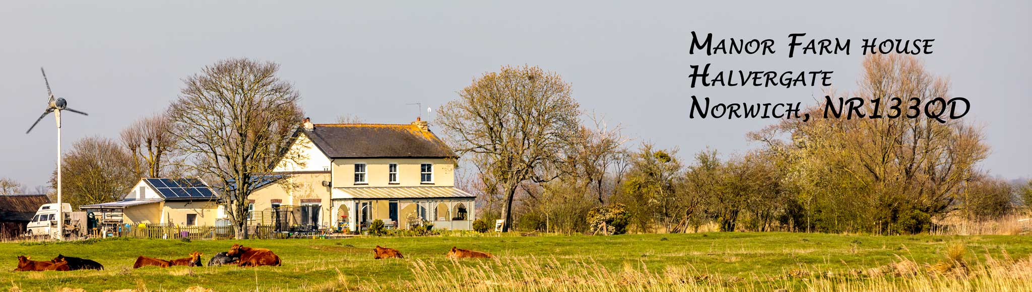
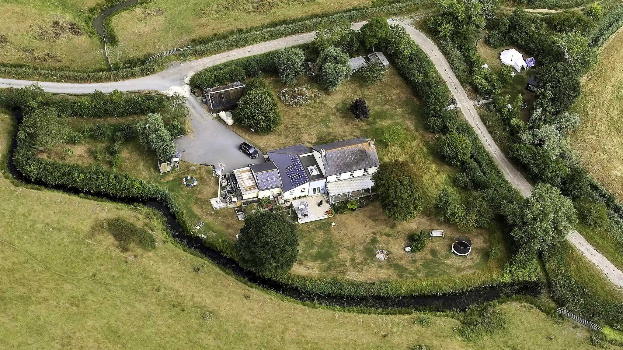
 Manor Farm House is a marsh house probably about ~200 years old. It sits on Halvergate Marsh all on its own. Halvergate Marsh is a 12,000 acre SSSI and part of the Broads National Park in the parish of Halvergate.
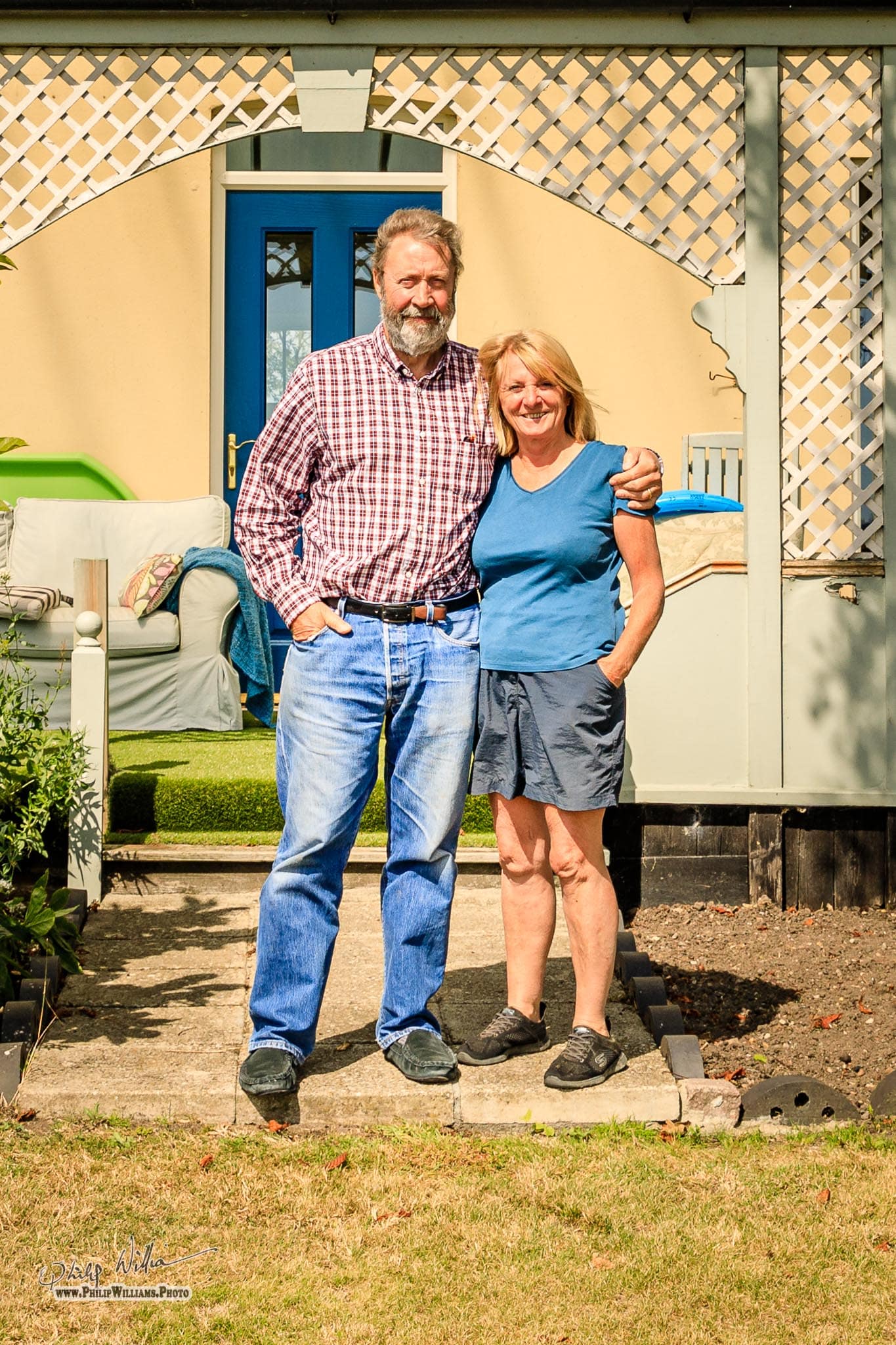
We, Julie & Philip Williams, moved here in October 2005. Being so old and isolated (the house, not us yet, but we are getting there!) presents us with several challenges. For example, we are not connected to the public electricity grid and BT broadband it is pitifully slow. At 6Km from the cabinet which is itself the furthest from the exchange it seems unlikely that we will get Fibre To The Premises (FTTP) and Fibre To The Cabinet (FTTC) won’t help much. However, we have successfully addressed both those issues - electricity, & broadband. There are many other challenges but well worth facing for the splendid views, the wildlife, and the peacefulness.
The intention of this site is to explore some of the history and development of the house and the surrounding marshes. There are some photo galleries of the house, the work we have carried out, and of the surrounding area. There are also some details of our power supply set up — diesel generator, solar panels, and wind turbine installation.
Muttons Mill is just outside the front of the house we have taken many pictures of the Mill over the years, this is a small selection.
Manor Farm House and Mutton's drainage mill — actually a wind pump — are mentioned in Sheila Hutchinson book "The Halvergate Fleet: Past and Present" which is currently out of print but may be available from the Mills Archive. There is also a Wikipedia entry for Mutton's Mill which is a listed building by Historic England. That site has an interesting video of the restoration carried out between 2018-2024. As of December 2024 the restoration project is complete and the mill is now turning into the wind but the sails are still braked.
Manor Farm House is located at WGS84: 52:36.21N 1:36.21E Datum: Ordnance Survey Great Britain 1936. Easting/Northing: 644103,306733. Grid Reference: TG4410306733. We can be found using what3words — https://what3words.com/elephant.annual.binders.
The house appears on a number of old maps.
 There are a number of Geograph pictures the grid square on which the house is located. Flash Earth was really neat but that sems to have sequed into Zoom Earth which claims to have satellite imagery and weather but it doesn't seem to have much detail..
We hope you enjoy the site and please do give us your comments and feedback —
We are both photographers and this is an ideal location for all sorts of photography — some of our work.
Philip & Julie Williams